Spatially Integrative Monitoring: Surface Cap Systems Monitoring
Most of the DOE legacy sites have surface capping or surface infiltration barrier systems to minimize infiltration into source zones containing residual contaminants. The integrity of the surface cap is critical to reduce infiltration into source zones containing residual contaminants. It is known that surface caps degrade over time, due to factors such as vegetation growth and preferential flow. The ALTEMIS team aims to establish the above/below-ground monitoring system of the surface cap including geophysics and UAV. Autonomous electrical resistivity and phase tomography (ERT) monitoring has the potential to achieve rapid and automated detection and identification of contaminant plumes as well as water infiltration within the vadose zone. In parallel, remote sensing-based characterization can identify subsidence, surface runoff patterns, and infiltration hotspots.
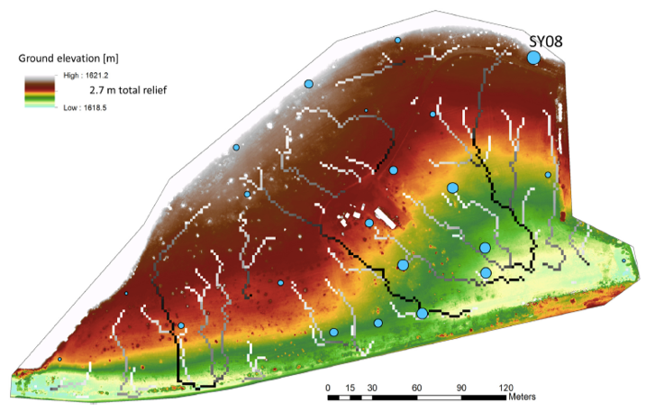
UAV-based imaging of high-resolution surface topography mapping and surface infiltration patterns from Christensen et al (2018).